During lockdown many of us rediscovered the joys of a simple walk. We found some super routes across East Kent, some woodland based, others with a coastal setting.
We will let you know of our planned walks with an agreed starting place and time. We have started to add some of our favourite walks below for you to look through. They contain recent photos and information on duration, terrain etc.
We will let you know of our planned walks with an agreed starting place and time. We have started to add some of our favourite walks below for you to look through. They contain recent photos and information on duration, terrain etc.
legal stuff
Whilst we are communicating this event via the Dance Club, this is not a Coastal Dance Club organised event. You are responsible for your own health and safety.
what to wear / bring
We will confirm the approximate duration and the terrain, although weather conditions will obviously affect this. This should allow you to choose the correct footwear/clothing.
The woodland routes will involve leaving the path and thus enclosed or sensible shoes are recommended (no flip flops). This is also the case for the Reculver walk which will be across a pebbly beach at low tide.
Please bring fluids to keep hydrated.
Our woodland routes are designed as circuits and those under 3 hours do not return to the car park until the end; with the longer combined route walks we will pass through the car park approximately mid-way.
Please be aware that the woodland car park does not have toilet facilities. There are toilet and drinking facilities mid-way through the Reculver walk.
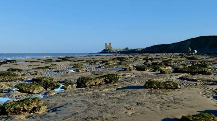
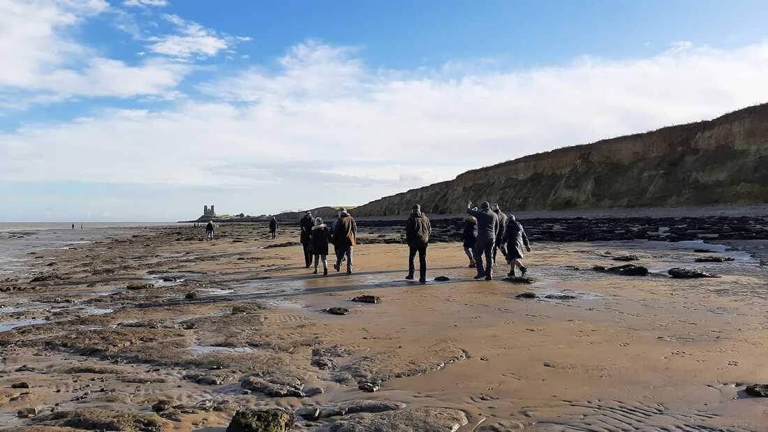
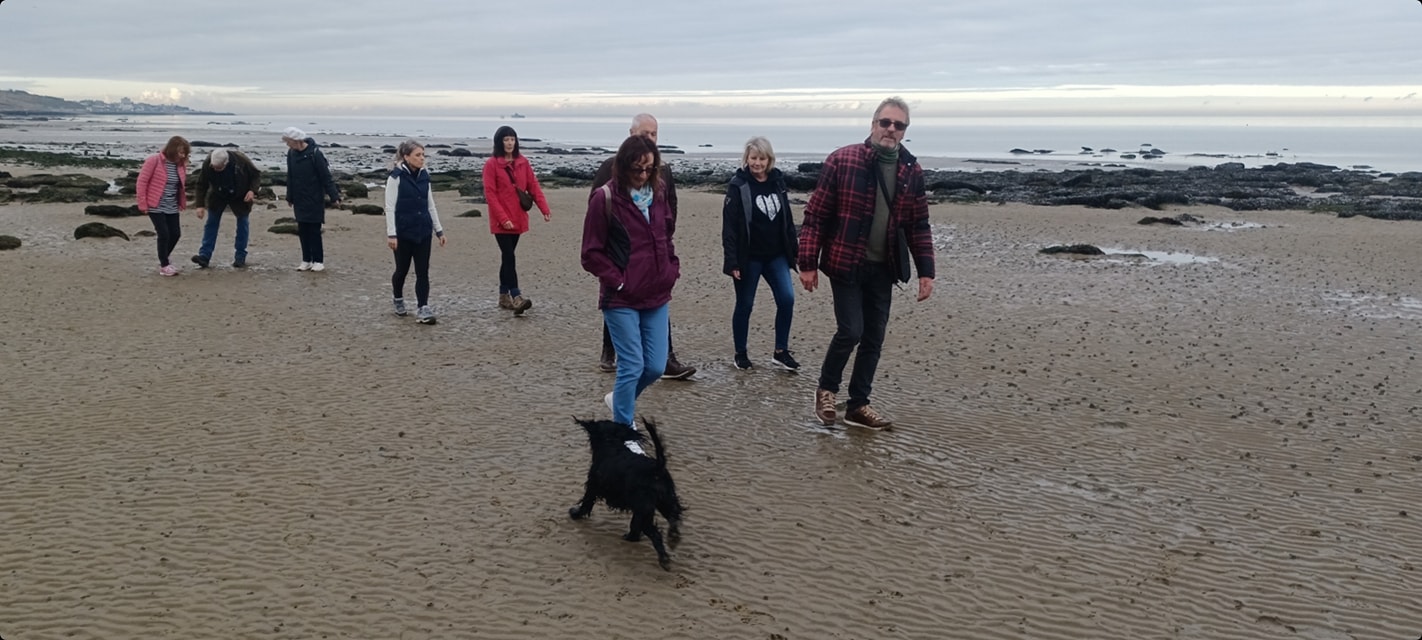
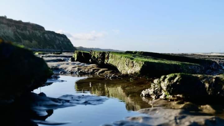
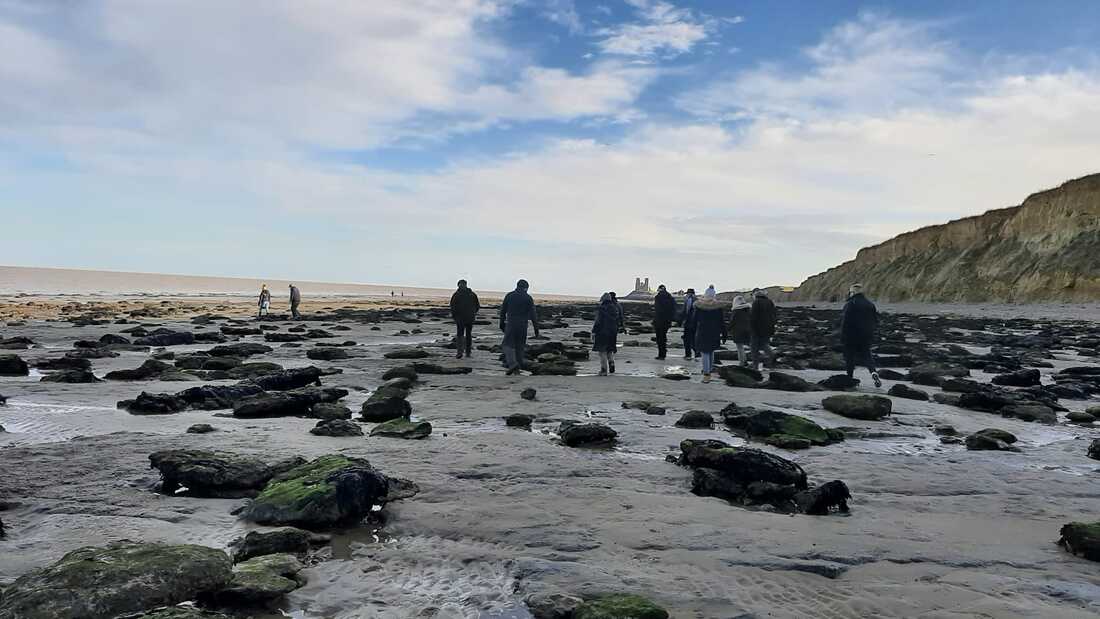
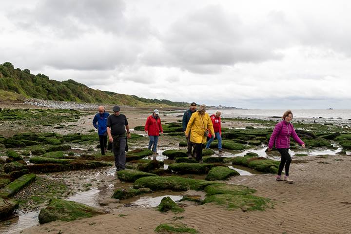
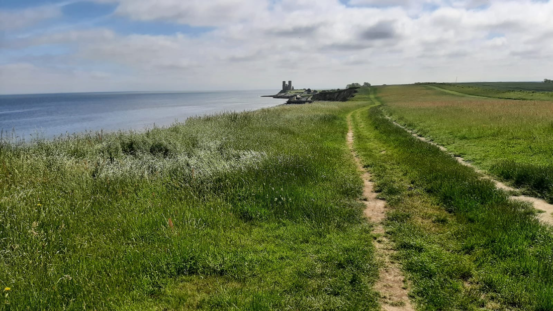
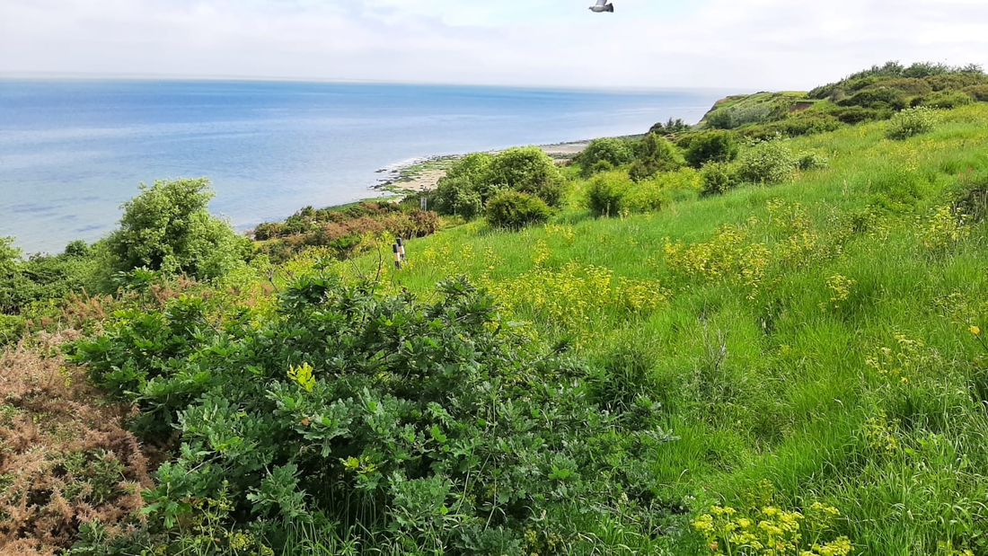
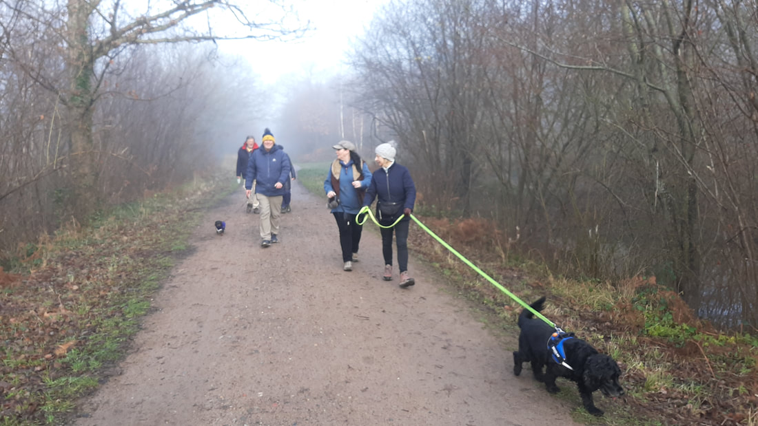
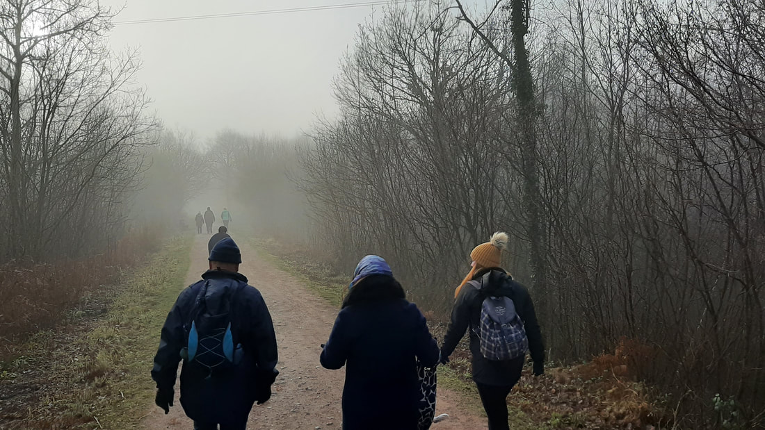
Reculver (Low Tide)
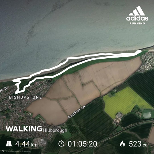
Route Duration: Approximately 1 hour, 6 minutes*
*based on 14:43 min/km, pace may vary subject to attendees.
Route Length: 4.44km / 2.75 miles
Estimated Calories Burned: 523
Terrain: Mostly flat with a slight undulating terrain in places.
Route Description: 40% pebble beach, 10% sand, 40% grass, 10% path (see photos below).
Rest Options: There are toilet and drinking facilities mid-way through this walk.
Parking: On-street parking 3 minutes away. Fee car park on-site.
Google Maps Link: Click Here
What3Words Link: gained.blend.each
click images to enlarge
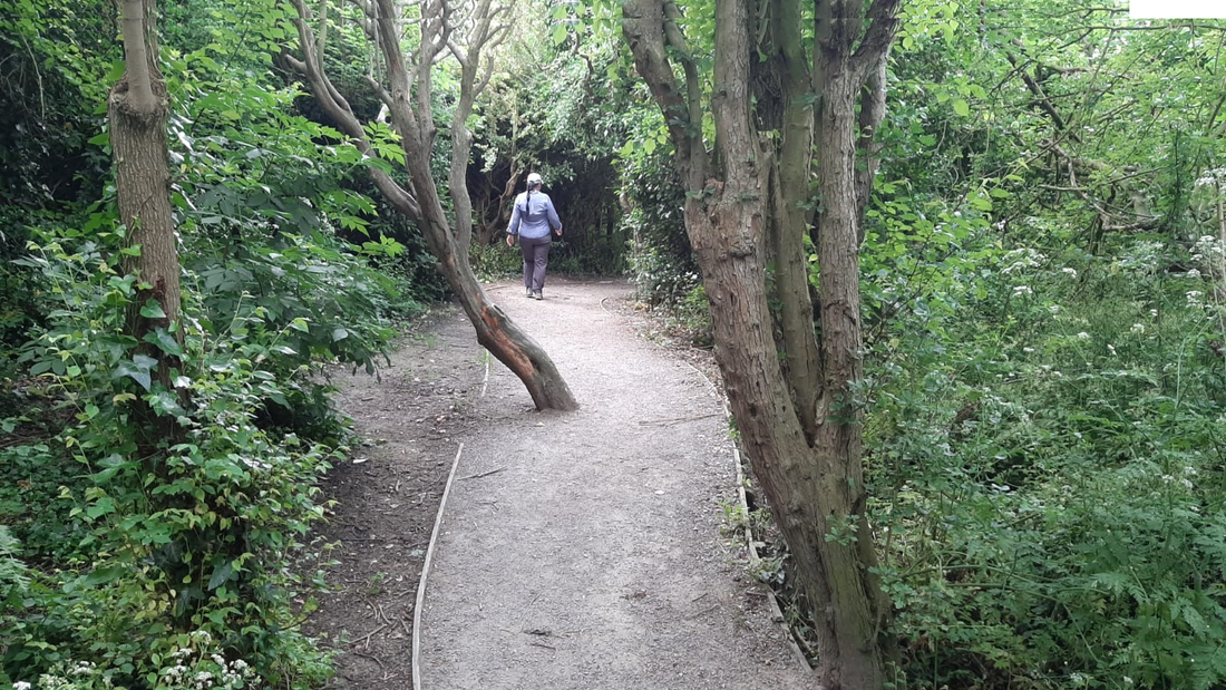
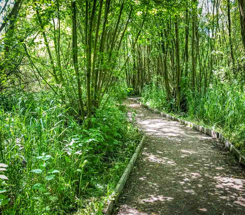
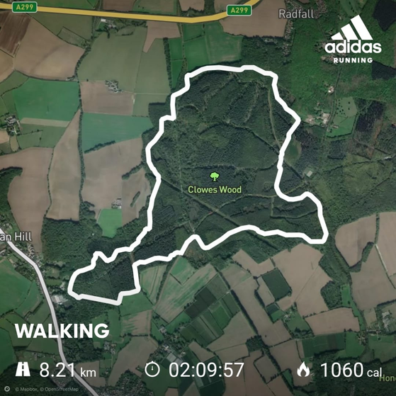
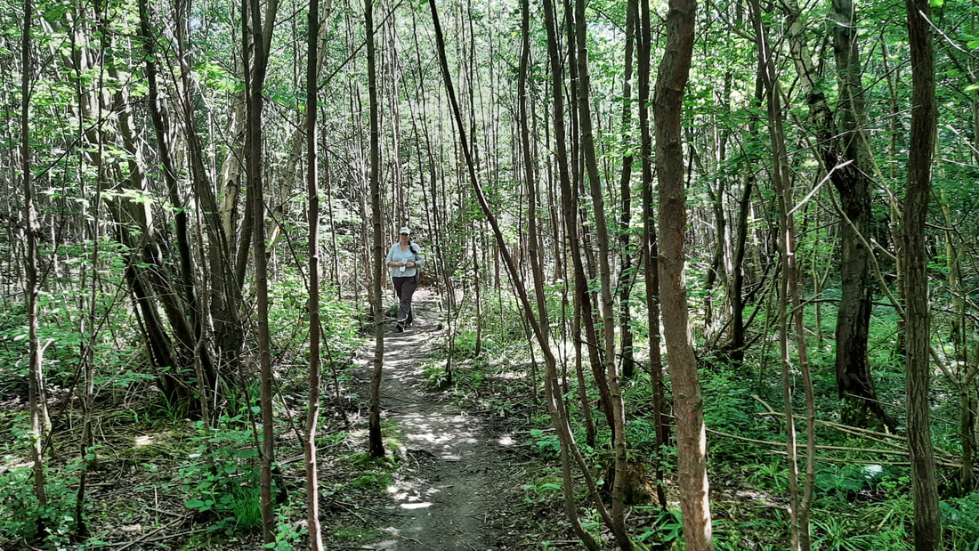
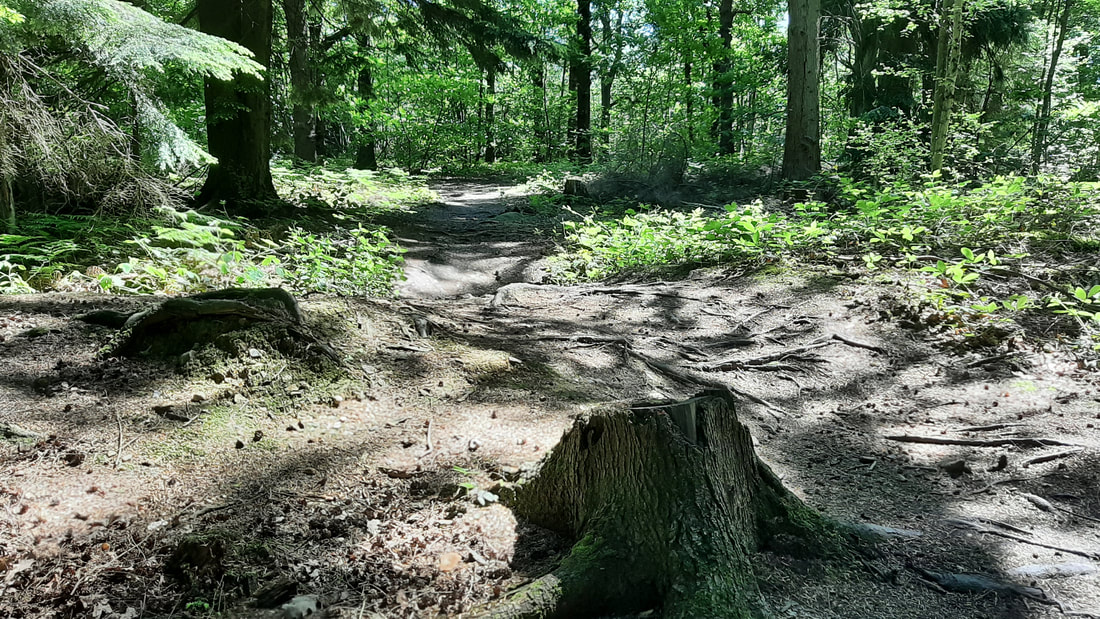
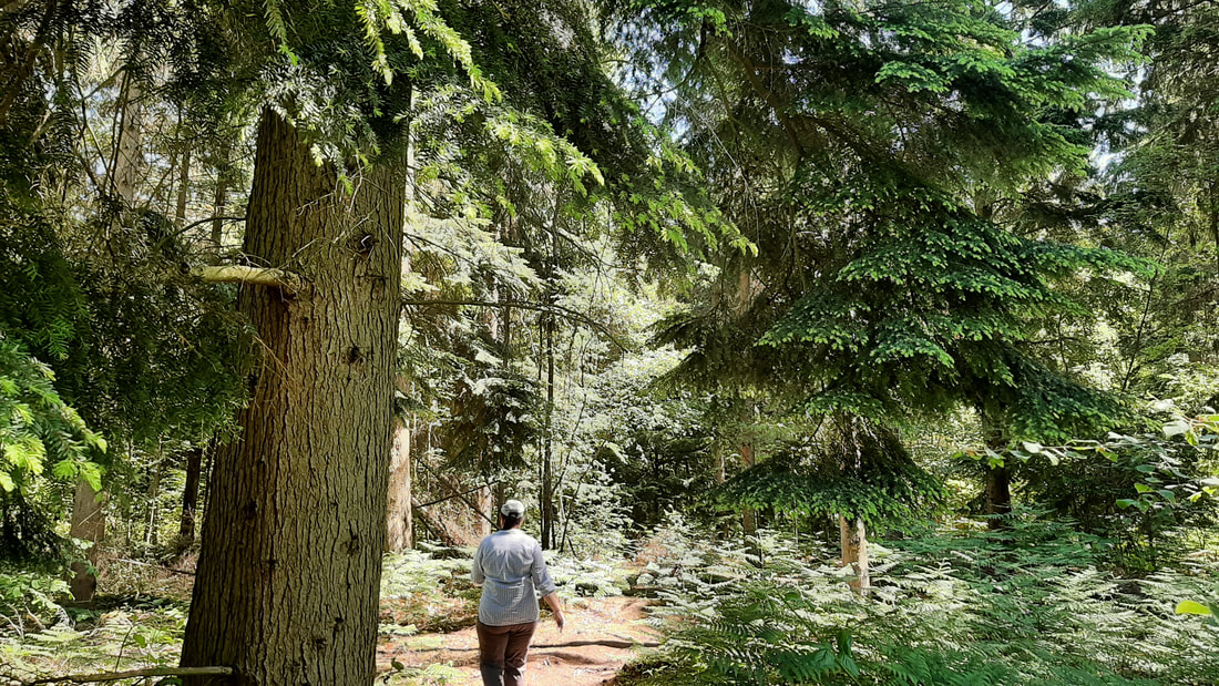
Clowes Wood (Long)
Route Duration: Approximately 2 hours, 10 minutes*
*based on 15:50 min/km, pace may vary subject to attendees.
Route Length: 8.21km / 5.10 miles
Estimated Calories Burned: 1060
Terrain: Mostly flat with a slight undulating terrain in places.
Route Description: 90% woodland, 10% path (see photos below).
Shortcut Options: Whilst 90% of the route is woodland, there is generally a path within 200 yards of the route at all times. The path is usually the fastest route back to the car park.
Parking: Free on-site parking.
Google Maps Link: Click Here
What3Words Link: fight.listings.thumb
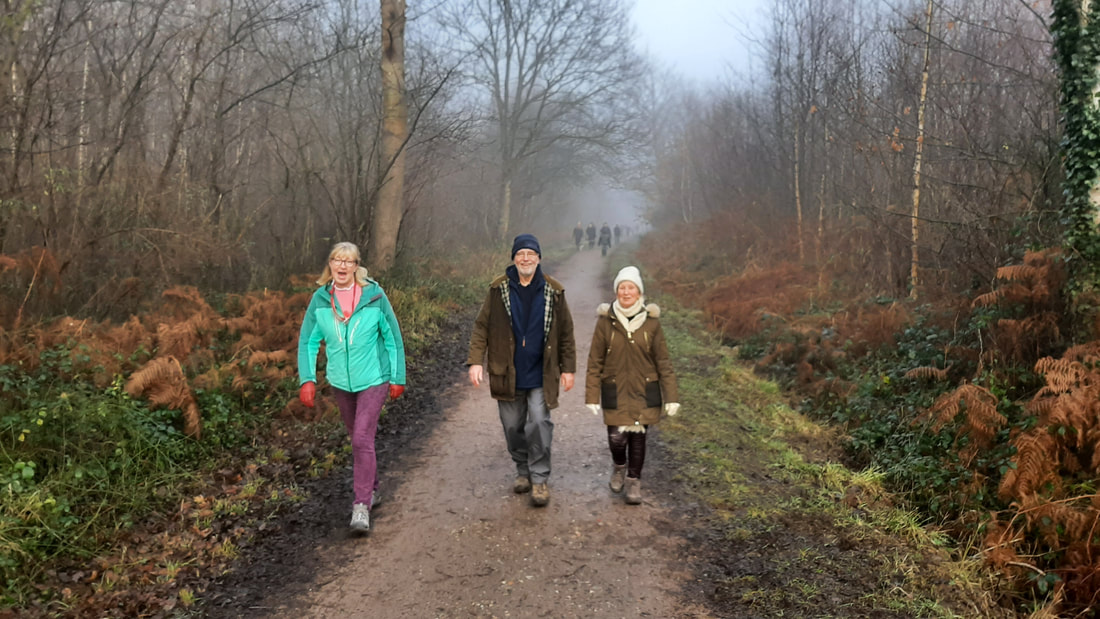
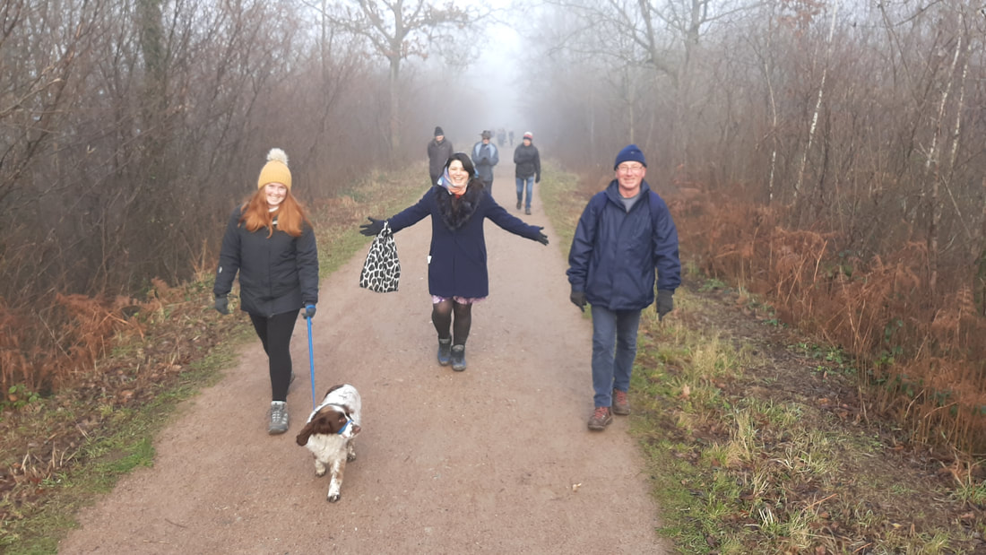
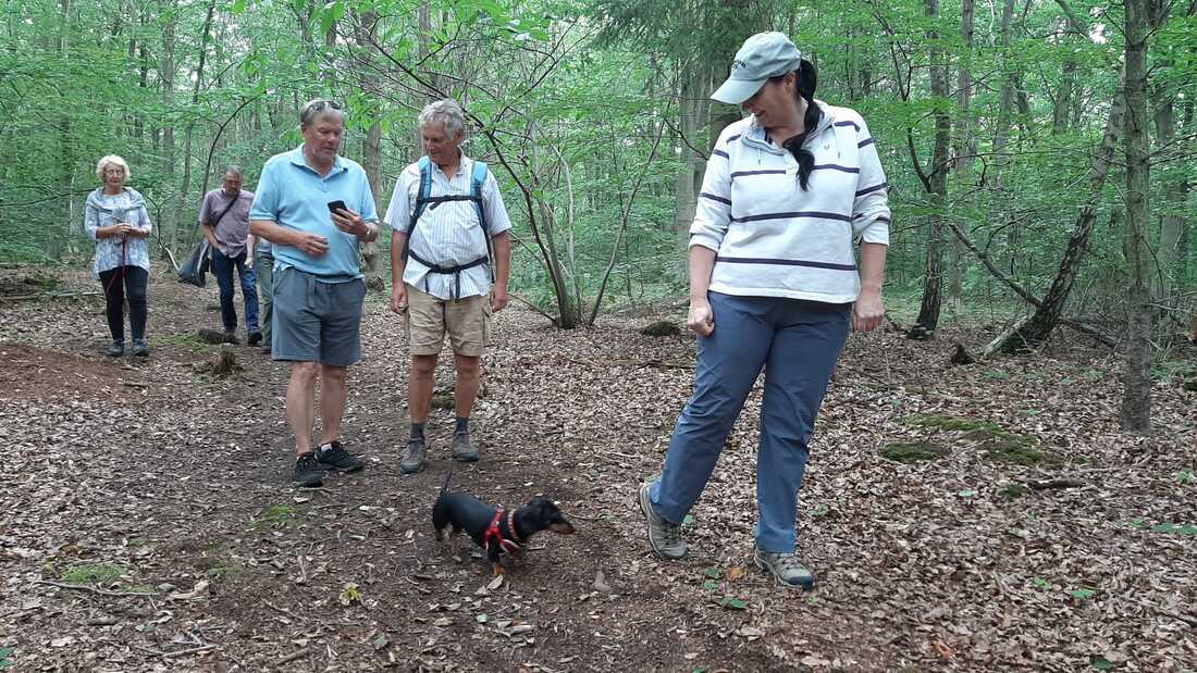
Clowes Wood (loop photos)


Clowes Wood (short)
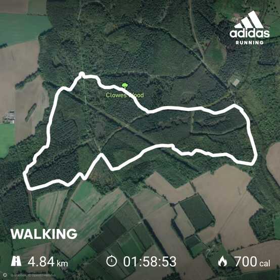
Route Duration: Approximately 2 hours*
*based on 24:34 min/km, pace may vary subject to attendees.
Route Length: 4.84km / 3.00 miles
Estimated Calories Burned: 700
Terrain: Mostly flat with a slight undulating terrain in places.
Route Description: 85% woodland, 15% path (see photos below).
Shortcut Options: Whilst 85% of the route is woodland, there is generally a path within 200 yards of the route at all times. The path is usually the fastest route back to the car park.
Parking: Free on-site parking.
Google Maps Link: Click Here
What3Words Link: fight.listings.thumb
click images to enlarge


Thornden Wood
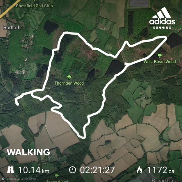
Route Duration: Approximately 2 hours, 22 minutes*
*based on 13:57 min/km, pace may vary subject to attendees.
Route Length: 10.14km / 6.30 miles
Estimated Calories Burned: 1172
Terrain: Mostly flat with a slight undulating terrain in places.
Route Description: 80% woodland, 20% path (see photos below).
Shortcut Options: Whilst 80% of the route is woodland, there is generally a path within 200 -400 yards of the route at all times. The path is usually the fastest route back to the car park.
Parking: Free on-site parking at Clowes Wood (the starting point of this walk).
Google Maps Link: Click Here
What3Words Link: fight.listings.thumb
click images to enlarge

CLOWES & THORNDEN woods combined
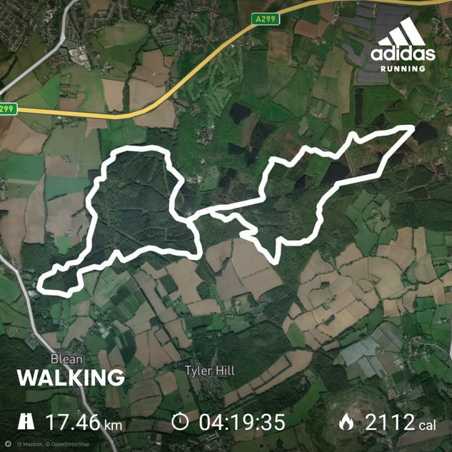
Route Duration: Approximately 4 hours, 20 minutes*
*based on 14:52 min/km, pace may vary subject to attendees.
Route Length: 17.46km / 10.84 miles
Estimated Calories Burned: 2112
Terrain: Mostly flat with a slight undulating terrain in places.
Route Description: 80% woodland, 20% path (see photos above).
Shortcut Options: Whilst 80% of the route is woodland, there is generally a path within 200 -400 yards of the route at all times. The path is usually the fastest route back to the car park.
Parking: Free on-site parking at Clowes Wood.
Google Maps Link: Click Here
What3Words Link: fight.listings.thumb
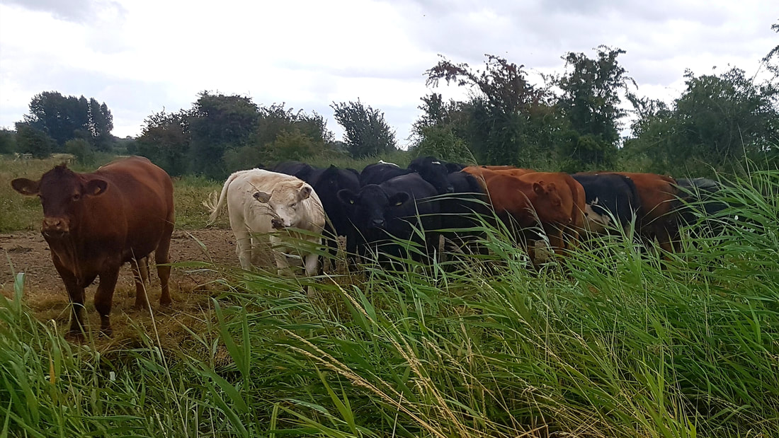
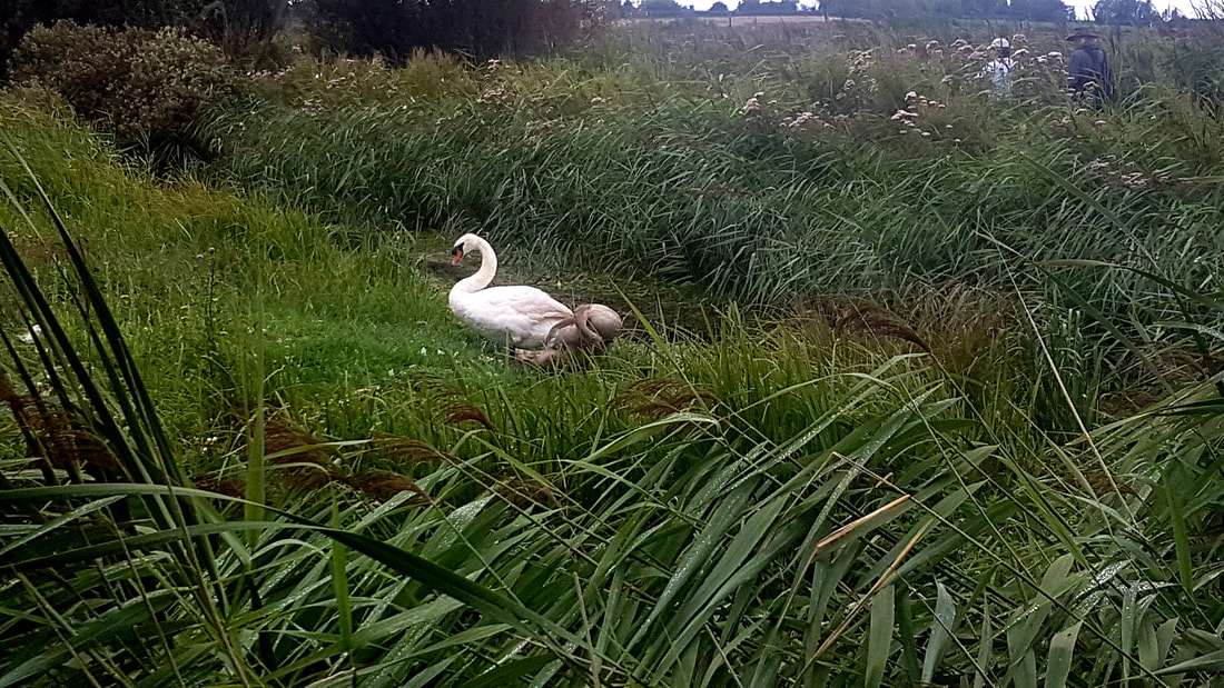
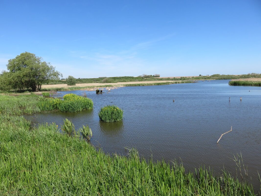
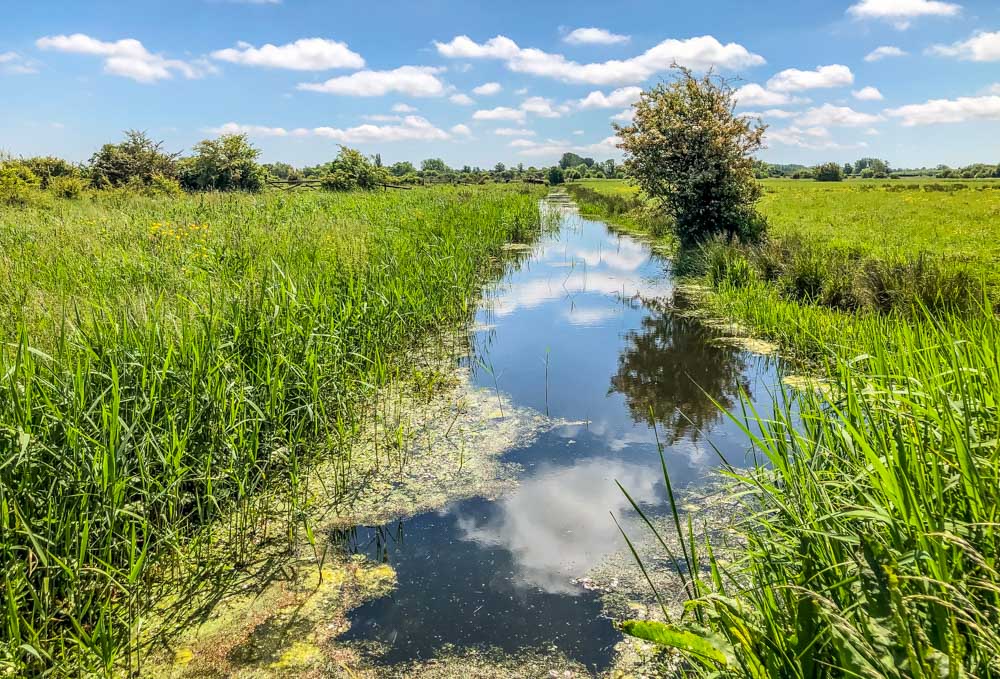
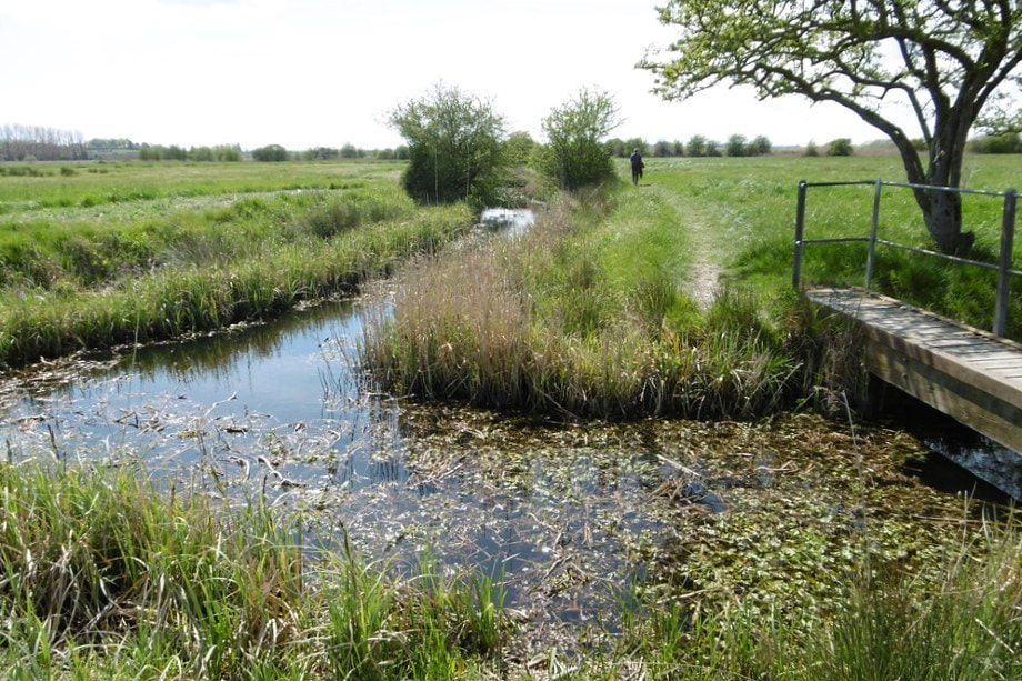
stodmarsh nature reserve
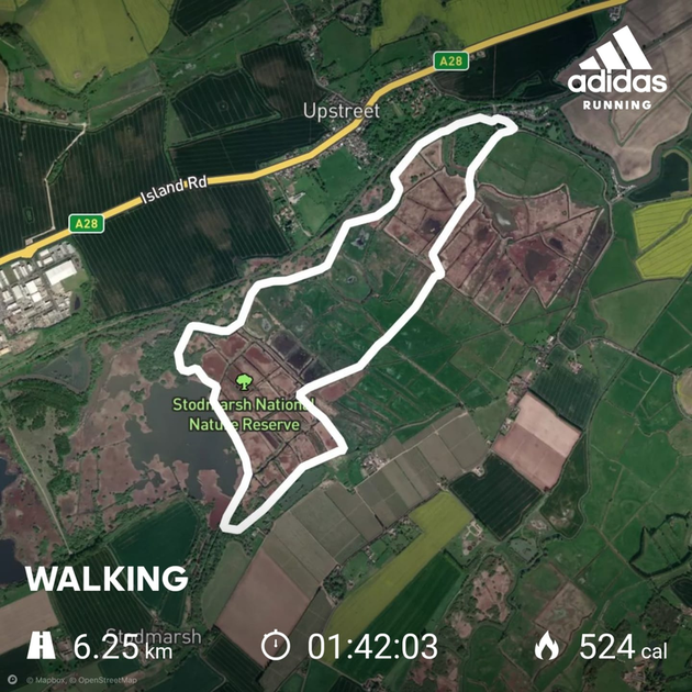
Route Duration: Approximately 1 hour, 45 minutes
Route Length: 6.25km / 3.88 miles
Estimated Calories Burned: 524
Terrain: Mostly flat.
Route Description: Gravel and grass path (see photos below).
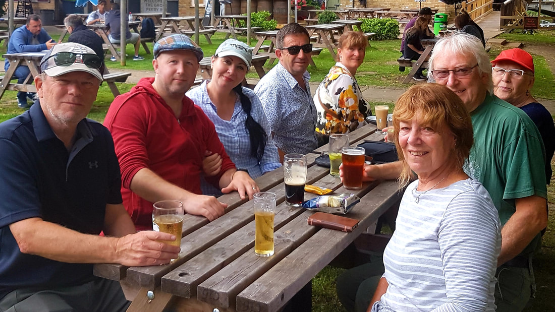
Parking: £1.50 per day - Grove Ferry Car Park
Google Maps Link: Click Here
What3Words Link: early.skewing.odds
Route Length: 6.25km / 3.88 miles
Estimated Calories Burned: 524
Terrain: Mostly flat.
Route Description: Gravel and grass path (see photos below).
Parking: £1.50 per day - Grove Ferry Car Park
Google Maps Link: Click Here
What3Words Link: early.skewing.odds
click images to enlarge